Clouds have fascinated humans for centuries, serving not only as celestial artwork but as nature’s most reliable weather forecasters revealing atmospheric conditions in real-time.
🌤️ The Fundamental Connection Between Clouds and Weather Systems
Understanding weather patterns begins with recognizing that clouds are visible manifestations of atmospheric processes. These suspended water droplets and ice crystals tell detailed stories about air movement, temperature variations, and moisture distribution throughout different atmospheric layers. Meteorologists have long relied on cloud observation as a primary tool for weather prediction, often before sophisticated technology became available.
The formation of clouds itself indicates specific atmospheric conditions. When warm, moist air rises and cools to its dew point, condensation occurs around microscopic particles called condensation nuclei. This process reveals critical information about temperature gradients, humidity levels, and atmospheric stability—all essential factors in weather forecasting.
Different cloud types emerge under distinct atmospheric conditions, making them reliable indicators of current weather and predictors of forthcoming changes. By learning to read these aerial signals, anyone can develop impressive weather prediction skills without relying solely on technological forecasts.
Decoding Cloud Types and Their Weather Messages
High-Altitude Clouds: Cirrus, Cirrostratus, and Cirrocumulus
Cirrus clouds appear as delicate, wispy strands resembling horse tails stretched across the sky at altitudes above 20,000 feet. These ice crystal formations typically indicate fair weather currently, but their appearance often precedes weather system changes within 24 hours. When cirrus clouds thicken and lower, they’re announcing an approaching warm front that may bring precipitation.
Cirrostratus clouds create thin, sheet-like veils across the entire sky, producing the characteristic halo effect around the sun or moon. This optical phenomenon occurs when light refracts through the ice crystals composing these high clouds. The presence of cirrostratus typically indicates that rain or snow will arrive within the next 12 to 24 hours, making them excellent long-range indicators.
Cirrocumulus clouds, often called “mackerel sky” due to their fish-scale appearance, consist of small white patches arranged in rows. While generally associated with fair weather, they can indicate atmospheric instability at high altitudes and sometimes precede cold fronts.
Mid-Level Clouds: Altocumulus and Altostratus
Altocumulus clouds form between 6,500 and 20,000 feet, appearing as gray or white patches with darker shading. These medium-sized cloud clusters often indicate changing weather conditions. When altocumulus clouds display a castellanus formation—vertical tower-like structures—they signal atmospheric instability and potential thunderstorm development later in the day.
Altostratus clouds create uniform gray or blue-gray sheets that partially or completely cover the sky. The sun may be dimly visible through these clouds, appearing as through frosted glass. Altostratus typically forms ahead of storms with continuous precipitation and indicates that rain or snow will likely begin within several hours.
Low-Level Clouds: Stratus, Stratocumulus, and Nimbostratus
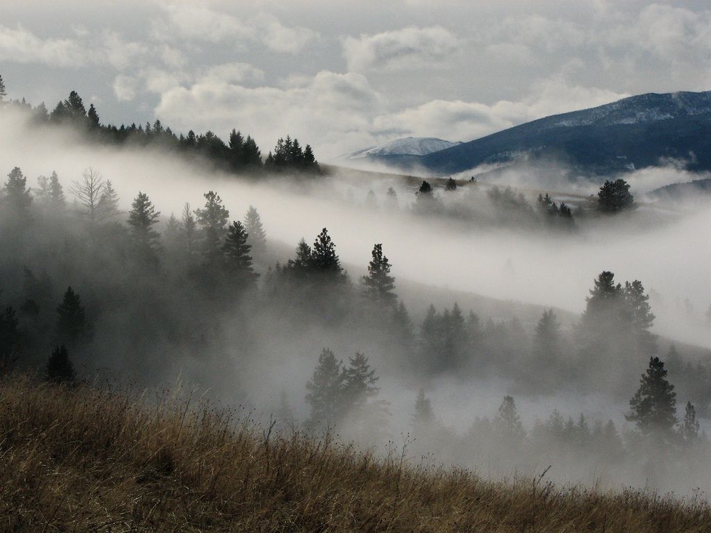
Stratus clouds form the lowest cloud layer, often appearing as uniform gray blankets covering the sky below 6,500 feet. These clouds frequently produce drizzle or light snow and are associated with stable, overcast conditions. Fog is essentially stratus clouds at ground level, both indicating high humidity and stable atmospheric conditions.
Stratocumulus clouds present as low, lumpy gray masses that often cover the entire sky in organized patterns. While they rarely produce significant precipitation, they indicate stable weather conditions that may persist for extended periods. These clouds typically form when weak atmospheric mixing occurs under temperature inversions.
Nimbostratus clouds are dark, thick, and shapeless layers that completely block sunlight, producing continuous moderate to heavy precipitation. The presence of nimbostratus indicates well-developed weather systems with sustained rainfall or snowfall likely to continue for several hours.
⛈️ Vertical Development Clouds: The Drama of Atmospheric Instability
Cumulus: Fair Weather to Foul
Cumulus clouds are perhaps the most recognizable cloud type, appearing as puffy white cotton balls with flat bases and rounded tops. Fair-weather cumulus (cumulus humilis) indicates stable atmospheric conditions with limited vertical development. These friendly clouds typically form during sunny days when surface heating creates thermal updrafts.
However, when atmospheric conditions become unstable with sufficient moisture and rising air continues upward, cumulus clouds can grow vertically throughout the day. Cumulus mediocris shows moderate vertical development, while cumulus congestus exhibits strong upward growth resembling cauliflower towers. This progression signals increasing atmospheric instability and the potential for severe weather development.
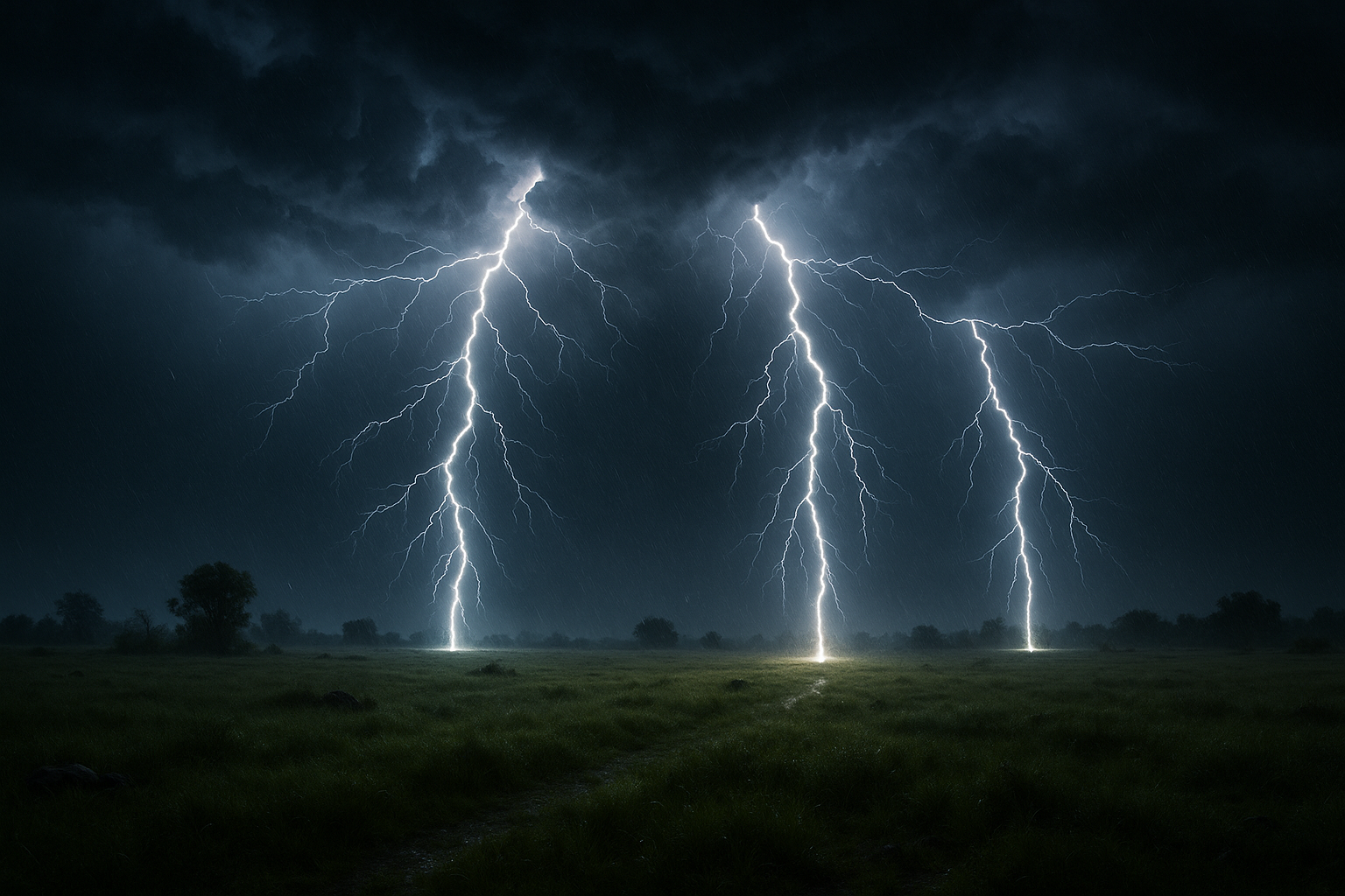
Cumulonimbus: Nature’s Most Powerful Weather Producers
Cumulonimbus clouds represent the ultimate expression of atmospheric instability, towering from near-surface levels to heights exceeding 50,000 feet. These massive cloud systems produce the most severe weather phenomena including heavy rain, hail, lightning, tornadoes, and damaging winds. The distinctive anvil-shaped top forms when the cloud reaches the tropopause and spreads horizontally.
Recognizing cumulonimbus cloud development early provides crucial warnings about impending severe weather. The appearance of mammatus clouds—pouch-like protrusions hanging from the cloud base—indicates extremely turbulent conditions within the storm system. Wall clouds, lowered rotating cloud bases beneath the main storm, can precede tornado formation.
For those interested in tracking severe weather conditions in real-time, weather radar applications provide essential information about approaching storms and their intensity.
Understanding Atmospheric Stability Through Cloud Observation
Atmospheric stability refers to the atmosphere’s resistance to vertical motion. Stable atmospheres suppress vertical air movement, while unstable conditions encourage rising air currents. Clouds provide visible evidence of these stability conditions through their formation patterns, shapes, and vertical extent.
Indicators of Stable Atmospheric Conditions
Stable atmospheres produce stratiform clouds—layered, sheet-like formations with limited vertical development. These conditions typically occur when cooler air overlies warmer air, creating a temperature inversion that prevents rising air currents. Stratus, altostratus, and nimbostratus clouds all indicate atmospheric stability.
Weather associated with stable conditions tends to be relatively calm and predictable. While widespread precipitation may occur from nimbostratus clouds, severe weather phenomena rarely develop in stable atmospheric environments. The persistence of fog, especially radiation fog forming overnight, also indicates stable surface conditions.
Signs of Unstable Atmospheric Conditions
Unstable atmospheres allow parcels of warm air to rise rapidly, cooling as they ascend. When these rising parcels remain warmer than surrounding air at the same altitude, they continue ascending, creating clouds with strong vertical development. Cumulus and cumulonimbus clouds are hallmarks of atmospheric instability.
Several visual cues indicate increasing instability:
- Rapid vertical growth of cumulus clouds throughout the day
- Development of towering cloud structures resembling cauliflower
- Dark cloud bases with bright, billowing tops
- Multiple thunderstorm cells forming in succession
- Presence of shelf clouds or arcus clouds at storm fronts
🌡️ Temperature Inversions and Cloud Formation Patterns
Temperature inversions occur when temperature increases with altitude rather than decreasing as normal. These inversions profoundly affect cloud formation and weather patterns, acting as atmospheric lids that trap air beneath them.
Surface-based inversions commonly form on clear, calm nights when the ground radiates heat rapidly. These conditions create shallow fog or stratus clouds that burn off as surface heating breaks the inversion. Persistent inversions, however, can trap pollutants and moisture near the surface, creating hazardous air quality conditions.
Elevated inversions occur at higher altitudes, often associated with high-pressure systems or frontal boundaries. These inversions can create distinct cloud layers with clear air between them. Pilots frequently encounter smooth flying conditions above inversions with turbulent air below, demonstrating the dramatic atmospheric differences these layers create.
Frontal Systems and Their Characteristic Cloud Sequences
Warm Front Cloud Progression
Warm fronts occur when warm air masses advance and override cooler air. The cloud sequence associated with approaching warm fronts follows a predictable pattern that serves as an excellent forecasting tool. The progression typically begins with cirrus clouds appearing 24-48 hours before the front arrives.
As the warm front approaches, cirrus thickens into cirrostratus, creating the characteristic halo effect. Cirrostratus then lowers and thickens into altostratus, with precipitation typically beginning when nimbostratus develops. This orderly cloud sequence provides advance warning of precipitation and allows accurate timing of the warm front’s arrival.
Cold Front Cloud Characteristics
Cold fronts move more rapidly than warm fronts, with denser cold air aggressively pushing beneath warmer air masses. The cloud patterns associated with cold fronts differ significantly from warm front sequences, often developing more suddenly with greater intensity.
Fast-moving cold fronts produce narrow bands of towering cumulus and cumulonimbus clouds along the frontal boundary. These systems can generate severe thunderstorms, heavy precipitation, and dramatic temperature drops. The weather typically clears rapidly behind cold fronts as high pressure builds in the wake of the system.
Slow-moving cold fronts may produce broader areas of stratiform clouds with more persistent precipitation patterns. Regardless of speed, cold fronts bring noticeable weather changes and wind shifts that are easily observable through cloud movements and formations.
📱 Modern Technology Meets Traditional Cloud Reading
While traditional cloud observation remains fundamentally important, modern technology enhances weather prediction capabilities significantly. Satellite imagery provides comprehensive views of cloud systems across entire continents, revealing large-scale patterns invisible from ground level.
Doppler radar penetrates clouds to detect precipitation intensity and motion, providing warnings about severe weather development. Weather apps combine multiple data sources including satellite imagery, radar data, surface observations, and computer models to generate detailed forecasts.
However, technology cannot replace the immediacy and specificity of direct cloud observation. Local topography, microclimates, and rapidly changing conditions require on-site assessment. The most accurate weather predictions combine technological tools with skilled observation of actual atmospheric conditions manifested in cloud formations.
Practical Cloud Observation Techniques for Weather Prediction
Developing Your Cloud Reading Skills
Learning to predict weather from clouds requires regular practice and systematic observation. Start by identifying basic cloud types and noting associated weather conditions. Maintain a weather journal documenting cloud observations, subsequent weather events, and forecast accuracy.
Pay attention to cloud movement directions at different altitudes, as variations indicate wind shear and potential weather system development. Observe how quickly clouds develop vertically—rapid growth suggests strong instability and possible severe weather.
Note the cloud base height and color. Lower, darker bases indicate greater moisture content and higher precipitation probability. Greenish tints in severe thunderstorm clouds suggest large hail presence, while orange or red coloration at sunset behind approaching clouds often precedes precipitation.
Key Observation Points for Accurate Predictions
Effective weather prediction from clouds requires attention to multiple factors simultaneously. Consider these essential observation points:
- Cloud type and altitude level
- Direction and speed of cloud movement
- Rate of vertical development or dissipation
- Changes in cloud coverage throughout the day
- Sequence of different cloud types appearing
- Optical phenomena like halos, sun dogs, or iridescence
- Presence of special features like mammatus or lenticular clouds
🌍 Regional Variations in Cloud Patterns and Weather Relationships
Cloud-weather relationships vary somewhat by geographic location and climate zone. Coastal regions experience different cloud patterns than continental interiors due to moisture availability and temperature contrasts. Mountainous areas create unique cloud formations through orographic lifting.
Tropical regions experience predominantly convective cloud systems with afternoon thunderstorm development. Mid-latitude areas see greater variety in cloud types as different air masses and frontal systems regularly pass through. Polar regions display unique cloud characteristics adapted to extreme cold and low moisture availability.
Understanding regional patterns enhances prediction accuracy. Local cloud formations develop in response to specific topographic features—sea breezes, valley winds, mountain wave clouds, and lake effect clouds all represent localized phenomena requiring familiarity with the area.
Ancient Wisdom Meets Scientific Understanding
For millennia before modern meteorology, humans relied entirely on cloud observation and other natural signs for weather prediction. Many traditional weather sayings contain genuine meteorological wisdom expressed in memorable phrases.
“Red sky at night, sailor’s delight; red sky in morning, sailors take warning” accurately reflects how sunlight interacting with atmospheric particles indicates high or low pressure positions. “Mackerel sky, not long dry” references cirrocumulus clouds that often precede frontal systems.
While folklore shouldn’t replace scientific understanding, it demonstrates humanity’s long recognition that clouds reveal atmospheric conditions. Modern meteorology has simply systematized and expanded this knowledge through precise classification systems and physical understanding of cloud formation processes.
⚡ Severe Weather Recognition Through Cloud Identification
Recognizing dangerous weather conditions early provides crucial safety advantages. Certain cloud features specifically indicate severe weather potential and warrant immediate attention.
Rotating wall clouds beneath thunderstorm bases indicate mesocyclone development and tornado potential. Shelf clouds—horizontal wedge-shaped formations at storm fronts—mark the leading edge of dangerous outflow winds. Funnel clouds obviously indicate tornado presence, though not all funnels reach the ground.
A sudden drop in cloud base height, especially with rapid movement, suggests strong downdrafts and potentially dangerous winds. Multiple cloud layers moving in different directions indicate significant wind shear that can support severe storm development.
Understanding these warning signs allows appropriate protective actions before dangerous weather arrives. When threatening clouds appear, monitoring weather alerts through reliable sources becomes essential for safety.
Enhancing Prediction Skills Through Continuous Learning
Weather prediction from cloud observation is both science and art, requiring knowledge combined with experience. Every observation provides learning opportunities as you correlate cloud appearances with subsequent weather developments.
Compare your predictions with actual weather outcomes to refine understanding. Notice patterns specific to your location and season. Study meteorological principles underlying cloud formation to deepen comprehension of what clouds reveal about atmospheric processes.
Photography helps document cloud formations and track their evolution over time. Time-lapse sequences particularly reveal cloud development patterns invisible to casual observation. Sharing observations with other weather enthusiasts through online communities provides additional learning perspectives.
🌤️ Putting Cloud Knowledge Into Daily Practice
Practical weather prediction improves planning for outdoor activities, travel, agriculture, and numerous other applications. Morning cloud observation establishes baseline conditions and trends for the day ahead. Checking cloud conditions multiple times daily reveals how atmospheric stability evolves.
Before outdoor events, assess cloud types and development patterns hours in advance. Rapidly building cumulus towers mid-morning suggest afternoon thunderstorm potential. Thickening cirrus followed by lowering altostratus indicates approaching precipitation within hours.
Agricultural operations particularly benefit from cloud-based weather prediction. Farmers have traditionally relied on cloud reading for harvest timing, irrigation scheduling, and frost prediction. The immediate, localized nature of cloud observation provides specificity that broad regional forecasts cannot match.
Mariners, aviators, and mountaineers depend on accurate weather assessment for safety. While professional forecasts provide essential guidance, direct cloud observation offers real-time updates about current conditions and imminent changes. In remote areas without reliable communication, cloud reading becomes the primary forecasting method.
By integrating cloud observation into daily routines, weather awareness becomes second nature. This skill connects us more deeply with natural environments while providing practical benefits across countless situations. The clouds continuously broadcast atmospheric conditions—learning their language transforms anyone into a competent weather forecaster equipped with knowledge used successfully for thousands of years.

Toni Santos is a visual storyteller and artisan whose creations celebrate the poetry of the natural world. Through his thoughtful artistic lens, Toni captures the elegance of botanical forms, transforming them into meaningful expressions of symbolism, resilience, and timeless beauty.
His journey is deeply rooted in a passion for flora and the mysteries they carry. From the shape of a petal to the curve of a vine, each design Toni brings to life reflects a deeper narrative — one of growth, transformation, and harmony with nature. Whether crafting symbolic floral jewelry, enchanted botanical illustrations, or seasonal visual studies, Toni’s work evokes the quiet magic found in Earth’s most delicate details.
With a background in handcrafted artistry and visual design, Toni blends technique with intention. His creations do more than decorate — they speak, often inspired by ancient meanings behind flowers, the cycles of the seasons, and the invisible bonds between nature and spirit.
As the creative voice behind Vizovex, Toni shares this botanical journey with the world, offering curated stories, handcrafted collections, and thoughtful articles that help others reconnect with nature’s symbolism and artistic essence.
His work is a tribute to:
The quiet power of flowers and their messages
The art of visual symbolism in everyday life
The beauty of slowing down to see what’s hidden in plain sight
Whether you’re an artist, a nature lover, or someone drawn to the deeper meanings behind the natural world, Toni welcomes you to explore a space where aesthetics meet soul — one petal, one story, one creation at a time.